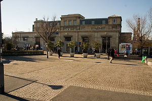
Saint-Denis station
Appearance
 | ||||||||||||||||
| General information | ||||||||||||||||
| Coordinates | 48°55′04″N 2°21′02″E / 48.917816°N 2.350474°E | |||||||||||||||
| Owned by | SNCF | |||||||||||||||
| Line(s) | Paris–Lille railway, Saint-Denis–Dieppe railway | |||||||||||||||
| Other information | ||||||||||||||||
| Station code | 87271015 | |||||||||||||||
| Fare zone | 3 | |||||||||||||||
| Services | ||||||||||||||||
| ||||||||||||||||
Saint-Denis is a railway station serving Saint-Denis, a northern suburb of Paris in Seine-Saint-Denis department, France. It is on the lines from Paris-Nord to Pontoise, Beauvais and Creil.
The station was the terminus of tramway T1 between 1992 and 2012 when the line was extended to Asnières – Gennevilliers – Les Courtilles. In 2014, a stop on tramway T8 was opened.
Gallery
-
Platforms
-
T1 tram stop
External links
Wikimedia Commons has media related to Gare de Saint-Denis.
- Saint-Denis station at Transilien, the official website of SNCF (in French)
- Saint-Denis station at "Gares & Connexions", the official website of SNCF (in French)


