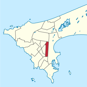
HLM (Dakar)
Appearance
HLM | |
|---|---|
Commune d'arrondissement | |
 HLM location | |
| Country | |
| Region | Dakar Region |
| Department | Dakar Department |
| Area | |
• Total | 2 km2 (0.8 sq mi) |
| Population (2013) | |
• Total | 39,126 |
| • Density | 20,000/km2 (51,000/sq mi) |
| Time zone | UTC+0 (GMT) |
HLM is a commune d'arrondissement of the city of Dakar, Senegal. As of 2013 it had a population of 39,126. HLM stands for Habitations à Loyer Modéré (Homes for moderate rents).
14°42′00″N 17°26′44″W / 14.70000°N 17.44556°W

