
Mainhardt
You can help expand this article with text translated from the corresponding article in German. (February 2009) Click [show] for important translation instructions.
|
Mainhardt | |
|---|---|
 Coat of arms | |
Location of Mainhardt within Schwäbisch Hall district 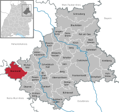 | |
 Mainhardt  Mainhardt | |
| Coordinates: 49°5′N 9°33′E / 49.083°N 9.550°E | |
| Country | Germany |
| State | Baden-Württemberg |
| Admin. region | Stuttgart |
| District | Schwäbisch Hall |
| Subdivisions | 5 Ortsteile |
| Government | |
| • Mayor | Damian Komor |
| Area | |
| • Total | 58.69 km2 (22.66 sq mi) |
| Elevation | 471 m (1,545 ft) |
| Population (2022-12-31)[1] | |
| • Total | 6,168 |
| • Density | 110/km2 (270/sq mi) |
| Time zone | UTC+01:00 (CET) |
| • Summer (DST) | UTC+02:00 (CEST) |
| Postal codes | 74535 |
| Dialling codes | 07903 |
| Vehicle registration | SHA |
| Website | www.mainhardt.de |
Mainhardt is a town in the district of Schwäbisch Hall in Baden-Württemberg in Germany.
See also
References
- ^ "Bevölkerung nach Nationalität und Geschlecht am 31. Dezember 2022" [Population by nationality and sex as of December 31, 2022] (CSV) (in German). Statistisches Landesamt Baden-Württemberg. June 2023.

| International | |
|---|---|
| National | |
| Geographic | |
This Schwäbisch Hall district location article is a stub. You can help Wikipedia by expanding it. |