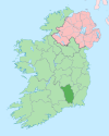
Killamery
This article needs additional citations for verification. (October 2020) |
Killamery
Cill Lamraí | |
|---|---|
Village | |
 The N76 through Killamery | |
| Coordinates: 52°28′42″N 7°26′50″W / 52.478337°N 7.447357°W | |
| Country | Ireland |
| Province | Leinster |
| County | County Kilkenny |
| Time zone | UTC+0 (WET) |
| • Summer (DST) | UTC-1 (IST (WEST)) |
| Website | www |
Killamery (Irish: Cill Lamraí) is a village in County Kilkenny, Ireland. It was the site of a famous monastery (c. 632) under the abbacy of St. Gobban, who died 639 and was buried in the hallowed grounds of St.Fintan of Clonenagh's Abbey, County Laois.
Killamery has a Celtic cross famous as part of the Ossory group of High crosses. This "west Ossory group" also includes the Celtic crosses at Ahenny, Kilkieran and Tibberaghny.
Two bullauns and a holy well are also found nearby.
The village is located near the County Tipperary border on the N76 National secondary road, halfway between Kilkenny to the northeast and Clonmel to the southwest.

There is one public house in the village, "The Auld House".[citation needed]


