Ega (river)
Appearance
| Ega | |
|---|---|
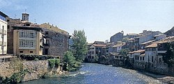
 The river Ega at Estella-Lizarra | |
 | |
| Location | |
| Country | Spain |
| Physical characteristics | |
| Source | |
| • location | Álava |
| • coordinates | 42°37′10″N 2°36′46″W / 42.61944°N 2.61278°W |
| Mouth | |
• location | Ebro |
• coordinates | 42°19′42″N 1°55′10″W / 42.32833°N 1.91944°W |
| Basin features | |
| Progression | Ebro→ Balearic Sea |
The Ega is a river in the north of Spain. It is a tributary of the Ebro. The Ega flows through Navarre, but it originates in Álava, near Lagrán, and flows through the town of Estella-Lizarra.
See also
