Črna, Idrija
Črna | |
|---|---|
| Coordinates: 45°59′36″N 14°06′23″E / 45.99333°N 14.10639°E | |
| Country | |
| Traditional region | Inner Carniola |
| Statistical region | Gorizia |
| Municipality | Idrija |
| Elevation | 851 m (2,792 ft) |
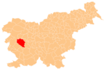
Črna (pronounced [ˈtʃəɾna]; Template:Lang-de[2]) is a formerly independent settlement in the western part of Dole in central Slovenia. It is part of the traditional region of Inner Carniola[2][3] and is now included with the rest of the municipality in the Gorizia Statistical Region.[4]
Geography
Črna lies in a set of clearings on a slope below Rupe Hill. The surrounding forest is a mix of spruce and beech. Black Gorge (Template:Lang-sl) lies below the settlement and Black Creek (Template:Lang-sl) flows through the gorge.[1]
History
In 1880 Črna had a population of 19 people living in three houses.[5] By 1900, there were only 13 people,[2] and by 1961 the population had declined to nine; this fell further to only five in 1965.[1] At the time, the settlement consisted of only three farms, one of which had been abandoned.[1] Črna was annexed by Dole in 1964, ending its existence as an independent settlement.[1][6] There was formerly a mill along Black Creek below the settlement; the remnants of a weir and a footbridge remain at the site.[1]
References
- ^ a b c d e f Savnik, Roman (1968). Krajevni leksikon Slovenije, vol. 1. Ljubljana: Državna založba Slovenije. p. 68.
- ^ a b c Leksikon občin kraljestev in dežel zastopanih v državnem zboru, vol. 6: Kranjsko. 1906. Vienna: C. Kr. Dvorna in Državna Tiskarna, p. 124.
- ^ Kindermann, Josef Karl, et al. 1795. Innerkrain oder der Adelsberger Kreis. Map, 1:730,000. Graz: Verlag Franz Xaver Miller.
- ^ "Občina Idrija - Pozdravljeni (Idrija municipal site)". idrija.si. Retrieved 2017-02-05.
- ^ Special-Orts-Repertorium von Krain. 1884. Vienna: Alfred Hölder, p. 90.
- ^ Spremembe naselij 1948–95. 1996. Database. Ljubljana: Geografski inštitut ZRC SAZU, DZS.


