Marktleuthen
Appearance
Marktleuthen | |
|---|---|
 Marktleuthen | |
Location of Marktleuthen within Wunsiedel im Fichtelgebirge district  | |
| Coordinates: 50°7′N 12°0′E / 50.117°N 12.000°E | |
| Country | Germany |
| State | Bavaria |
| Admin. region | Oberfranken |
| District | Wunsiedel im Fichtelgebirge |
| Subdivisions | 10 Ortsteile |
| Government | |
| • Mayor | Florian Leupold (SPD) |
| Area | |
| • Total | 35.49 km2 (13.70 sq mi) |
| Elevation | 529 m (1,736 ft) |
| Population (2023-12-31)[1] | |
| • Total | 2,878 |
| • Density | 81/km2 (210/sq mi) |
| Time zone | UTC+01:00 (CET) |
| • Summer (DST) | UTC+02:00 (CEST) |
| Postal codes | 95168 |
| Dialling codes | 09285 |
| Vehicle registration | WUN |
| Website | www.marktleuthen.de |
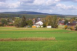
Marktleuthen (German: [ˌmaʁktˈlɔɪ̯tn] ) is a municipality in the district of Wunsiedel, in Bavaria, Germany. It is situated on the river Eger, 10 km north of Wunsiedel and 11 km southwest of Selb.
Transportation
The town has a train station and lies on the Regensburg-Hof railway.
References
- ^ Genesis Online-Datenbank des Bayerischen Landesamtes für Statistik Tabelle 12411-003r Fortschreibung des Bevölkerungsstandes: Gemeinden, Stichtag (Einwohnerzahlen auf Grundlage des Zensus 2011).


