
Lobith
Lobith | |
|---|---|
| Coordinates: 51°51′42″N 6°7′5″E / 51.86167°N 6.11806°E | |
| Country | Netherlands |
| Province | Gelderland |
| Municipality | Zevenaar |
Lobith is a village in the Dutch province of Gelderland. It is located in the municipality of Rijnwaarden. Traditionally, it is said that the Rhine enters the Netherlands at Lobith, although in reality, this happens about 4 km further upstream, near Spijk.
Lobith was a separate municipality for a short while between 1 March 1817 and 1 January 1818, when it became a part of Herwen en Aerdt.[1]
Gallery
-
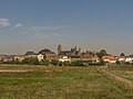 View to the village
 -
 Reformed church
 -
 Windmill: Tolhuys Coornmolen


References
- ^ Ad van der Meer and Onno Boonstra, "Repertorium van Nederlandse gemeenten", KNAW, 2006. "Archived copy". Archived from the original on 2007-02-20. Retrieved 2009-12-03.
{{cite web}}: CS1 maint: archived copy as title (link)
51°52′N 6°07′E / 51.867°N 6.117°E
This Gelderland location article is a stub. You can help Wikipedia by expanding it. |