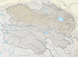
West Dabusun Lake
| West Dabusun Lake | |
|---|---|
| |
| Location | Golmud County Haixi Prefecture Qinghai Province China |
| Coordinates | 37°05′00″N 94°47′21″E / 37.08333°N 94.78917°E |
| Type | Endorheic ephemeral saline lake |
| Primary inflows | Yuejin River (Golmud) |
| Basin countries | China |
| Surface area | 30 km2 (12 sq mi) |
| Surface elevation | 2,675 m (8,776 ft) |
| West Dabusun Lake | |||||||||
|---|---|---|---|---|---|---|---|---|---|
| Chinese name | |||||||||
| Traditional Chinese | 西達布遜湖 | ||||||||
| Simplified Chinese | 西达布逊湖 | ||||||||
| Literal meaning | West Dabusun Lake | ||||||||
| |||||||||
| Mongolian name | |||||||||
| Mongolian script | ᠪᠠᠷᠠᠭᠤᠨ ᠳᠠᠪᠤᠰᠤᠨ ᠨᠠᠭᠤᠷ | ||||||||
| |||||||||
West Dabusun or Dabuxun Lake is an ephemeral lake northwest of Golmud in the Haixi Prefecture of Qinghai Province in northwestern China. Comprising a basin in the Qarhan Playa, it fills when meltwater floods the Golmud River, causing it to spill into subsidiary channels west of the main course to Dabusun Lake. Like the other lakes of the surrounding Qaidam Basin, it is extremely saline.
Name
Dabusun[1][2][3] or Dabsan[4] is a romanization of a Mongolian name meaning "Salt Lake".[5] The adjective "west" distinguishes it from nearby Dabusun Lake.[5] Dabuxun[6] is the pinyin romanization of the Mandarin pronunciation of the same name's transcription into characters. Xi Dabsan[4] or Xidabuxun[7] are the same names, prefixed with the Chinese word for "West".
Geography
West Dabusun Lake lies in the Dabusun subbasin[8] in the central Qarhan Playa in the southeastern corner of the Qaidam Basin[6] at an elevation of 2,675 m (8,776 ft).[4] Although sometimes listed as perennial, it is an ephemeral saline lake fed by the "Yuejin River" (t 躍進河, s 跃进河, Yuèjìn Hé),[9] a subsidiary western channel of the Golmud that periodically fill with meltwater.[10] It usually reaches a size of about 30 km2 (12 sq mi).[4] In Qaidam's hyperarid climate, there is generally only 28–40 mm (1–2 in) of annual rainfall but about 3,000 mm (120 in) of annual evaporation;[7] the accumulated pool evaporates before the end of the year. It is never more than about 1 m (3 ft 3 in) deep.[7]
The lake's position towards the southern end of the playa means that its waters are relatively less influenced by the concentrated mineral springs along the playa's northern boundary.[11]
History
West Dabusun Lake formed in 1967.[2]
See also
References
Citations
- ^ Spencer & al. (1990), p. 406.
- ^ a b Zhang (1990).
- ^ Lowenstein & al. (2009), pp. 75–6.
- ^ a b c d Zheng (1997), p. 15
- ^ a b Jia (2019).
- ^ a b Spencer & al. (1990), p. 396.
- ^ a b c Yu & al. (2001), p. 62.
- ^ Du & al. (2018), pp. 2–3.
- ^ Yu & al. (2009), p. 2.
- ^ Spencer & al. (1990), p. 397.
- ^ Spencer & al. (1990), pp. 398–399.
Bibliography
- Du Yongsheng; et al. (April 2018), "Evalutation of Boron Isotopes in Halite as an Indicator of the Salinity of Qarhan Paleolake Water in the Eastern Qaidam Basin, Western China", Geoscience Frontiers, vol. Vol. 10, No. 1, Beijing: China University of Geosciences, pp. 1–10, doi:10.1016/j.gsf.2018.02.016
{{citation}}:|volume=has extra text (help). - Jia Xiru (20 February 2019), "Qīnghǎi Měnggǔyǔ Dìmíng de Jǐge Tèsè 青海蒙古語地名的幾個特色 [Several Characteristics of Mongolian Placenames in Qinghai]", Xuěhuā Xīnwén 雪花新闻 [Snowflake News] (in Chinese).
- Lowenstein, Timothy K.; et al. (2009), "Closed Basin Brine Evolution and the Influence of Ca–Cl Inflow Waters: Death Valley and Bristol Dry Lake, California, Qaidam Basin, China, and Salar de Atacama, Chile", Aquatic Geochemistry, vol. Vol. 15, Springer, pp. 71–94, doi:10.1007/s10498-008-9046-z
{{citation}}:|volume=has extra text (help). - Spencer, Ronald James; et al. (1990), "Origin of Potash Salts and Brines in the Qaidam Basin, China" (PDF), Fluid-Mineral Interactions: A Tribute to H.P. Eugster, Special Publication No. 2, Geochemical Society.
- Yu Ge; et al. (2001), Lake Status Records from China: Data Base Documentation (PDF), MPI-BGC Tech Rep, No. 4, Jena: Max Planck Institute for Biogeochemistry.
- Yu Shengsong; et al. (2009), Chá'ěrhán Yánhé Zīyuán: Kěchíxù Lìyòng Yánjiū 察尔汗盐河资源: 可持续利用研究 [Qarhan Playa Resources: A Study of Sustainable Use] (PDF) (in Chinese), Beijing: Kexue Chubanshe.
- Zhang Baozhen; et al. (1990), "Hydrogen and Oxygen Stable Isotope Analyses of Fluid Inclusions in Halite in Charhan Salt Lake with Geochemical Implications", Acta Sedimentologica Sinica, vol. Vol. 8, No. 1, Lanzhou: Academy Sinica, pp. 3–17
{{citation}}:|volume=has extra text (help). - Zheng Mianping (1997), An Introduction to Saline Lakes on the Qinghai–Tibet Plateau, Dordrecht: Kluwer Academic Publishers.

