
Arabela, New Mexico
Arabela, New Mexico | |
|---|---|
 Arabela  Arabela | |
| Coordinates: 33°35′13″N 105°10′24″W / 33.58694°N 105.17333°W | |
| Country | United States |
| State | New Mexico |
| County | Lincoln |
| Elevation | 5,479 ft (1,670 m) |
| Time zone | UTC-7 (Mountain (MST)) |
| • Summer (DST) | UTC-6 (MDT) |
| ZIP codes | 88351[1] |
| Area code | 575 |
| GNIS feature ID | 903252[2] |
Arabela is an unincorporated community located in Lincoln County, New Mexico, United States. Arabela is located in a rural part of eastern Lincoln County, 23.2 miles (37.3 km) east of Capitan.
A post office was established in 1901 and named Arabela by Andy Richardson, who became smitten with a local Apache woman, Arabela Barela. Barela, who with her sisters Damiana Barela and Carolina “Caro” Romero, owned and operated several cathouses in the area. The post office closed in 1928.[3]
References
- ^ "Postmaster Finder - Post Offices by ZIP Code". United States Postal Service. Retrieved November 30, 2014.
- ^ "Arabela". Geographic Names Information System. United States Geological Survey, United States Department of the Interior.
- ^ Julyan, Robert (1996). The Place Names of New Mexico. University of New Mexico Press. p. 20. ISBN 0826316891.
Municipalities and communities of Lincoln County, New Mexico, United States | ||
|---|---|---|
| City | 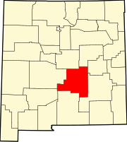 | |
| Town | ||
| Villages | ||
| CDP | ||
| Other unincorporated communities | ||
| Ghost towns | ||
This New Mexico state location article is a stub. You can help Wikipedia by expanding it. |