Morningside, New Mexico
Morningside, New Mexico | |
|---|---|
| Coordinates: 32°51′40″N 104°23′49″W / 32.86111°N 104.39694°W | |
| Country | United States |
| State | New Mexico |
| County | Eddy |
| Area | |
| • Total | 0.090 sq mi (0.23 km2) |
| • Land | 0.090 sq mi (0.23 km2) |
| • Water | 0 sq mi (0 km2) |
| Elevation | 3,373 ft (1,028 m) |
| Population | |
| • Total | 367 |
| • Density | 4,100/sq mi (1,600/km2) |
| Time zone | UTC-7 (Mountain (MST)) |
| • Summer (DST) | UTC-6 (MDT) |
| Area code | 575 |
| GNIS feature ID | 2584157[2] |
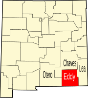
Morningside is an unincorporated community and census-designated place in Eddy County, New Mexico, United States. Its population was 367 as of the 2010 census.[1] The community is located on the northern border of Artesia west of U.S. Route 285.
Geography
Morningside is located at 32°51′40″N 104°23′49″W / 32.861009°N 104.397071°W. According to the U.S. Census Bureau, the community has an area of 0.090 square miles (0.23 km2), all land.[1]
References


