
Lantry, South Dakota
Lantry, South Dakota | |
|---|---|
 Lantry Location within the state of South Dakota  Lantry Lantry (the United States) | |
| Coordinates: 45°0′52″N 101°25′52″W / 45.01444°N 101.43111°W | |
| Country | United States |
| State | South Dakota |
| County | Dewey |
| Time zone | UTC-6 (Central (CST)) |
| • Summer (DST) | UTC-5 (CDT) |
| ZIP codes | 57636 |
Lantry is an unincorporated community in Dewey County, South Dakota, United States. Although not tracked by the Census Bureau, Lantry has been assigned the ZIP code of 57636.[1]
According to the Federal Writers' Project, the origin of the name Lantry is obscure.[2]
References
- ^ "Lantry, SD ZIP Codes". SD HomeTownLocator. HTL, Inc. Retrieved 2008-09-12.
- ^ Federal Writers' Project (1940). South Dakota place-names, v.1-3. University of South Dakota. p. 47.
Municipalities and communities of Dewey County, South Dakota, United States | ||
|---|---|---|
| Cities | 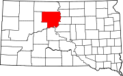 | |
| Town | ||
| CDPs | ||
| Other communities | ||
| Indian reservations | ||
| Footnotes | ‡This populated place also has portions in an adjacent county or counties | |
| International | |
|---|---|
| National | |
This South Dakota state location article is a stub. You can help Wikipedia by expanding it. |