Wich'iqucha (Jauja)
Appearance
| Wich'iqucha | |
|---|---|
| Location | Junín Region |
| Coordinates | 11°53′26″S 75°52′21″W / 11.89056°S 75.87250°W |
| Basin countries | Peru |
| Wich'iqucha Dam | |
|---|---|
| Dam and spillways | |
| Height | 5.5 m (18 ft) |
| Power Station | |
| Operator(s) | Electroperu |
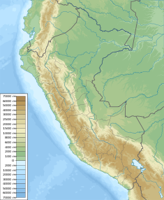
Wich'iqucha (Quechua wich'i a large, wide-mouthed pitcher, qucha lake,[1] "pitcher lake", Hispanicized spelling Vichecocha) is a lake in Peru. It is situated in the Junín Region, Jauja Province, Canchayllo District, west of Yuraqqucha. The lake belongs to the watershed of the Mantaro River.[2][3]
The Wich'iqucha dam was built in 1995. It is 5.5 m (6.0 yd) high. It is operated by Electroperu.[3]
See also
[edit]References
[edit]- ^ Teofilo Laime Ajacopa (2007). Diccionario Bilingüe: Iskay simipi yuyayk’anch: Quechua – Castellano / Castellano – Quechua (PDF). La Paz, Bolivia: futatraw.ourproject.org.
- ^ escale.minedu.gob.pe - UGEL map of the Jauja Province (Junín Region)
- ^ a b Obras hidraulicos en la cuenca de Mantaro - fuente : fuente: Electroperu - Inventario proyectos de afianzamiento hidrico Cuenca del Rio Mantaro, 2005


