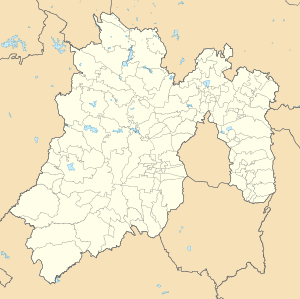
Santa Lucía, Zumpango
Santa Lucía | |
|---|---|
| Coordinates: 19°44′53″N 98°58′57″W / 19.74806°N 98.98250°W | |
| Country | |
| State | Mexico |
| Municipality | Zumpango |
| Elevation | 2,249 m (7,379 ft) |
| Population (2010)[1] | |
| • Total | 3,639 |
| Time zone | UTC-6 (Central Standard Time) |
| • Summer (DST) | UTC-5 (Central Daylight Time) |
Santa Lucía is a town located in the State of Mexico in Mexico. It belongs to the municipality of Zumpango, being located at its southeast end, within the facilities of the Mexico City Santa Lucía Airport.
References
- ^ Instituto Nacional de Estadística y Geografía (2016). "Número de habitantes. Mexico".

