
Zell, South Dakota
Zell is an unincorporated community in Faulk County, South Dakota, United States, astride U.S. Route 212, and was once a stop on the old Chicago and North Western Railway[1]
History
A post office called Zell has been in operation since 1885.[2] Zell was platted in 1886.[3] Some say the community's name honors the local Zell family of settlers,[4] while others believe the community was named after one or more of the places named Zell in Germany, Austria or Switzerland.[3]
St. Mary's Church, School and Convent was founded in Zell in 1883. The Catholic school served the community until 1963. The complex was listed on the National Register of Historic Places in 1982.
The Chicago & North Western Railway constructed a rail line from Redfield to Faulkton in 1886.[5] Zell was a stop on the railway that year, providing the Zell Farmers Elevator with transportation of grain.
In 1970, the Chicago & North Western Railway abandoned its rail line from Redfield to Gettysburg, leaving Zell without rail service.[6]
The town is mentioned in Tillie Olsen’s unfinished novel Yonnondio. The Holbrooks become tenant farmers there after they leave the coal mining community in Wyoming.[7]
References
- ^ U.S. Geological Survey Geographic Names Information System: Zell, South Dakota
- ^ "Faulk County". Jim Forte Postal History. Retrieved 2 April 2015.
- ^ a b Chicago and North Western Railway Company (1908). A History of the Origin of the Place Names Connected with the Chicago & North Western and Chicago, St. Paul, Minneapolis & Omaha Railways. p. 142.
- ^ Federal Writers' Project (1940). South Dakota place-names, v.1-3. University of South Dakota. p. 69.
- ^ http://history.sd.gov/Preservation/OtherServices/SDRailroad.pdf | p=80
- ^ http://history.sd.gov/Preservation/OtherServices/SDRailroad.pdf%7C p = 87
- ^ Olson, Tillie (1974). Yonnondio. United States: Bison Books. ISBN 0-440-09196-9.
Municipalities and communities of Faulk County, South Dakota, United States | ||
|---|---|---|
| City | 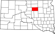 | |
| Towns | ||
| CDPs | ||
| Unincorporated communities | ||
44°53′49″N 98°43′42″W / 44.89694°N 98.72833°W
| International | |
|---|---|
| National | |
This South Dakota state location article is a stub. You can help Wikipedia by expanding it. |