Search results
Appearance
The page "Datum water level" does not exist. You can create a draft and submit it for review or request that a redirect be created, but consider checking the search results below to see whether the topic is already covered.
- reservoir relative to a specified vertical datum. Water level (device), device utilizing the surface of liquid water to establish a local horizontal plane...1 KB (80 words) - 03:52, 29 April 2024
- A chart datum is the water level surface serving as origin of depths displayed on a nautical chart and for reporting and predicting tide heights. A chart...10 KB (1,156 words) - 00:08, 23 July 2024
- global MSL is a type of vertical datum – a standardised geodetic datum – that is used, for example, as a chart datum in cartography and marine navigation...23 KB (4,104 words) - 03:03, 16 July 2024
- bathymetry, water level, and built structures) and altitudes of satellite orbits and in aviation. In planetary science, vertical datums are also known...11 KB (1,471 words) - 02:22, 14 September 2024
- NAP markers in Amsterdam Amsterdam Ordnance Datum or Normaal Amsterdams Peil (NAP) is a vertical datum in use in large parts of Western Europe. Originally...4 KB (552 words) - 09:12, 16 June 2024
- datum (AOD). Usually mean sea level (MSL) at a particular place is used for the datum. In Great Britain, OD for the Ordnance Survey is Ordnance Datum...7 KB (778 words) - 22:49, 30 October 2024
- In surveying, reduced level (RL) refers to equating elevations of survey points with reference to a common assumed vertical datum. It is a vertical distance...4 KB (457 words) - 06:02, 23 May 2024
- vertical datum is used to measure the elevation or depth relative to a standard origin, such as mean sea level (MSL). A three-dimensional datum enables...31 KB (3,368 words) - 17:55, 7 November 2024
- The North American Datum (NAD) is the horizontal datum now used to define the geodetic network in North America. A datum is a formal description of the...13 KB (1,613 words) - 16:56, 12 November 2024
- Hydraulic head (redirect from Fresh water head)in a column of water using a standpipe piezometer by measuring the height of the water surface in the tube relative to a common datum. The hydraulic head...13 KB (1,863 words) - 05:16, 31 October 2024
- The reference water levels are used on inland waterways to define a range of water levels allowing the full use of the waterway for navigation. Ship passage...5 KB (549 words) - 20:03, 3 November 2024
- scarce up to the 1970s. The longest running sea-level measurements, NAP or Amsterdam Ordnance Datum were established in 1675, in Amsterdam. Record collection...208 KB (21,941 words) - 13:41, 15 November 2024
- invert level is the base interior level of a pipe, trench or tunnel; it can be considered the "floor" level. The invert is an important datum for determining...4 KB (479 words) - 20:03, 11 September 2024
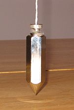
- Plumb bob (redirect from Plumb bob level)line, or plumb-line. It is a precursor to the spirit level and used to establish a vertical datum. It is typically made of stone, wood, or lead, but can...6 KB (624 words) - 00:11, 7 February 2024
- geometric dimensioning and tolerancing Chart datum, level of water depth on a nautical chart Datum or datum point, a (possibly arbitrary) reference baseline...960 bytes (162 words) - 12:01, 12 December 2023
- Tide (redirect from High water)water level over time. Gauges ignore variations caused by waves with periods shorter than minutes. These data are compared to the reference (or datum)...109 KB (13,082 words) - 18:00, 25 October 2024
- Tide gauge (redirect from Water level sensor)level relative to a vertical datum. It is also known as a mareograph, marigraph, and sea-level recorder. When applied to freshwater continental water...9 KB (865 words) - 20:21, 27 July 2024
- Vertical position (redirect from Level (coordinate))line direction) above or below a given vertical datum (a reference level surface, such as mean sea level). Vertical distance or vertical separation is the...8 KB (821 words) - 05:30, 11 August 2024
- recent, the weather and water conditions may not have changed much and drift can be estimated with some confidence. Search datum is the estimated position...14 KB (1,980 words) - 00:39, 2 November 2024
- Lake Superior (category Articles using infobox body of water without alt)period of October 1925 to June 1926, water levels ranged from 1.58 feet (0.48 m) to 0.33 feet (0.10 m) below Chart Datum. In the summer of 2007 monthly historic...51 KB (5,003 words) - 03:04, 24 September 2024
- supplementary methods. The mean sea-level surface used as a reference (vertical datum) is determined by averaging the hourly water heights for a specified period
- and the rest of the page remains blank for we still cannot find a single datum that remains true under all possible circumstances, nor evidence of the
- allow the recording of water depth (from an arbitrary datum point) and extent of inundation over the seasons. The height of water on these pegs should be


