Ábrego
Ábrego | |
|---|---|
Municipality of Colombia | |
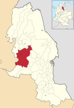
 Location of Ábrego in Norte de Santander | |
| Coordinates: 8°00′N 73°12′W / 8.000°N 73.200°W | |
| Country | |
| Department | Norte de Santander |
| Subregion | Western |
| Founded | 12 March 1810 |
| Government | |
| • Mayor | Huber Darío Sánchez Ortega (2016-2019) |
| Area | |
| • Total | 1,582 km2 (611 sq mi) |
| Elevation | 1,398 m (4,587 ft) |
| Population (2015) | |
| • Total | 38,627 |
| • Density | 24/km2 (63/sq mi) |
| Time zone | UTC-5 (Colombia Standard Time) |
| Climate | Aw |
| Website | Official website |
Ábrego (Spanish pronunciation: [ˈaβɾeɣo]) is a Colombian municipality and town located in the department of Norte de Santander. The urban centre is situated at an altitude of 1,398 metres (4,587 ft) in the Eastern Ranges of the Colombian Andes.[1]
References
- ^ (in Spanish) Official website Ábrego


