
Madimba Territory
Madimba is a territory in the Kongo Central province of the Democratic Republic of the Congo.[1] Its seat is the town of Madimba.
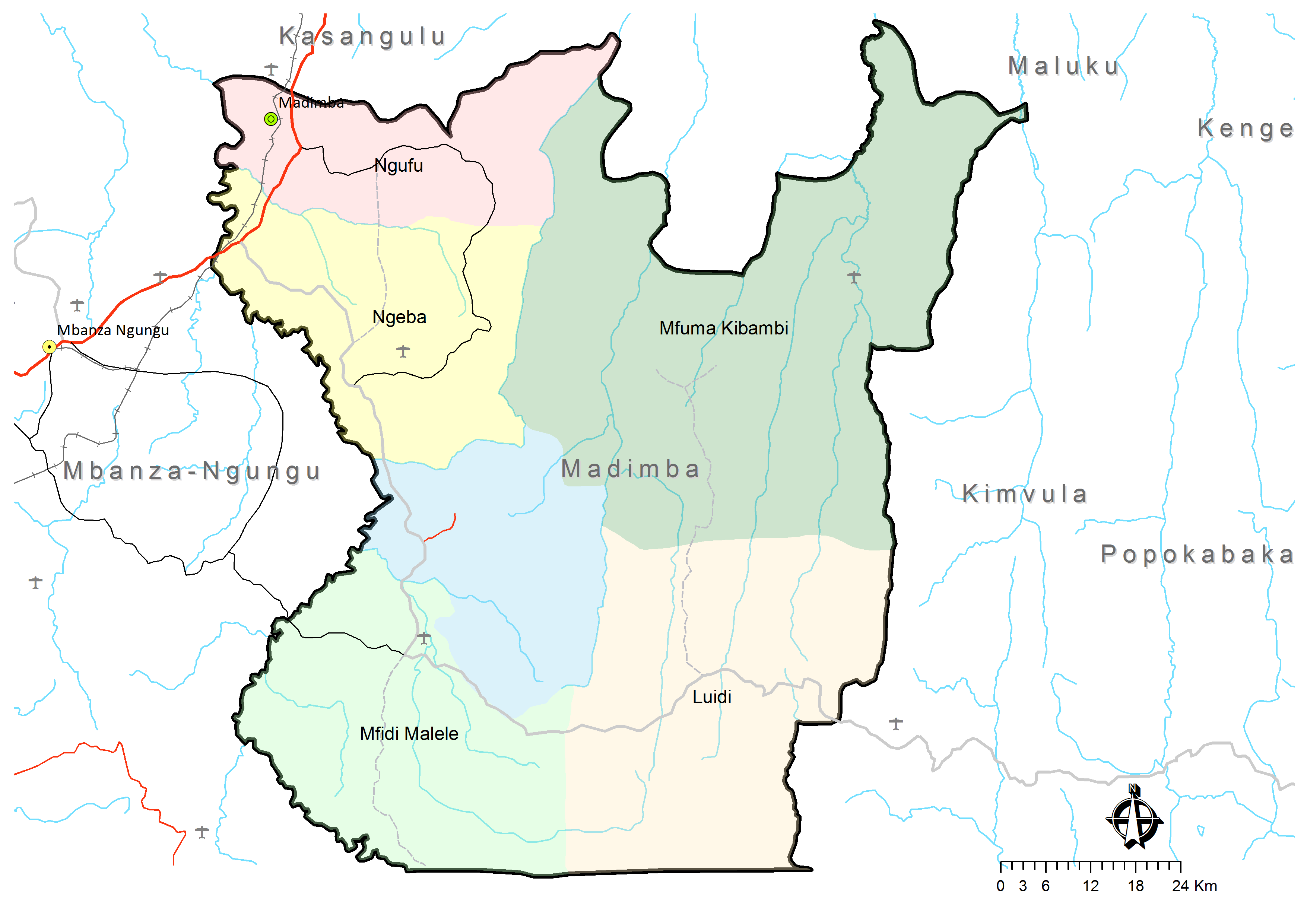
The major rivers that cut across Madimba Territory are the Congo and its tributary the Inkisi. Other rivers include the Lukusu, Luidi, Mfidi, Ngufu, Geba, Wungu, Nsele, Tau, Luvu, Lukunga and Bongolo.[2]
Administrative divisions
Madimba Territory covers 8,260 km2[1] and is divided into six administrative divisions or "sectors":[3]
- Luidi
- Mfidi Malele
- Mfuma Kibambi
- Ngeba
- Ngufu
- Wungu (south of Ngeba, north of Mfidi Malele)
References
- ^ a b "Territoire de Madimba: Fiche du territoire". Cellule d'Analyses des Indicateurs de Développement (CAID). Archived from the original on 30 May 2018.
- ^ "Territoire de Madimba: Fiche du territoire: Données géographiques et culturelles". Cellule d'Analyses des Indicateurs de Développement (CAID). Archived from the original on 30 May 2018.
- ^ Territoire de Madimba: Carte administrative (Map). Cellule d'Analyses des Indicateurs de Développement (CAID). Archived from the original on 30 May 2018.
| Cities | |
|---|---|
| Territories | |
| Populated places | |
| Other | |
4°9′S 15°2′E / 4.150°S 15.033°E
This Democratic Republic of the Congo location article is a stub. You can help Wikipedia by expanding it. |