San Martín, Cesar
San Martín | |
|---|---|
town | |
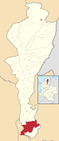
 Location of the municipality and town of San Martín in the Department of Cesar. | |
| Country | Colombia |
| Region | Caribbean |
| Department | Cesar |
| Government | |
| • Mayor | Elber José Guerra (Convergencia Ciudadana)[1] |
| Population (Census 2018[2]) | |
| • Total | 20,452 |
| Time zone | UTC-5 |
| Website | www.sanmartin-cesar.gov.co |
San Martín is a town and municipality in the Colombian Department of Cesar.
References
- ^ (in Spanish) Interpolitico.com: Mayors of Cesar - 2008-2011 Archived 2007-11-01 at the Wayback Machine
- ^ "Censo Nacional de Población y Vivienda 2018" (in Spanish). DANE. Retrieved 25 April 2020.
External links
- (in Spanish) Gobernacion del Cesar, San Martin

