
Albert, New South Wales
| Albert New South Wales | |
|---|---|
 Albert Anglican Church | |
 Albert | |
| Coordinates | 32°21′S 147°30′E / 32.350°S 147.500°E |
| Population | 81 (2016 census)[1] |
| Postcode(s) | 2873 |
| Location | |
| LGA(s) | Lachlan Shire |
| State electorate(s) | Barwon |
| Federal division(s) | Parkes |
Albert is a town in the Central West region of New South Wales, Australia. The town is in the Lachlan Shire local government area, 481 kilometres (299 mi) west north west of the state capital, Sydney. At the 2016 census, Albert had a population of 81.[1]
Gallery
 | The image captions in this gallery require cleanup to comply with Wikipedia guidelines for trivial wording. (January 2018) |
-
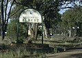 Outside Albert township
 -
 Albert Hotel


References
Wikimedia Commons has media related to Albert, New South Wales.
- ^ a b Australian Bureau of Statistics (27 June 2017). "Albert (State Suburb)". 2016 Census QuickStats. Retrieved 1 February 2018.
This New South Wales geography article is a stub. You can help Wikipedia by expanding it. |