Amicalola Falls
Appearance
| Amicalola Falls | |
|---|---|
 (view from the 'Reflecting Pool' at bottom) | |
 | |
| Location | Dawson County, Georgia, United States |
| Coordinates | 34°34′3″N 84°14′40″W / 34.56750°N 84.24444°W |
| Type | Cascade |
| Elevation | 1,900 ft (580 m) |
| Total height | 729 feet (222 m) |
| Watercourse | Little Amicalola Creek |
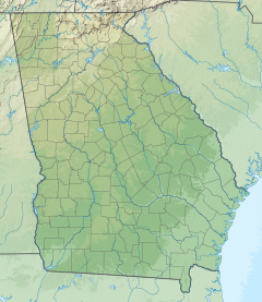
Amicalola Falls is a 729-foot (222 m) waterfall on Amicalola Creek in Dawson County, Georgia, United States. It the highest waterfall in Georgia and is considered to be one of the Seven Natural Wonders of Georgia.[1] The name "Amicalola" is derived from a Cherokee language word meaning "tumbling waters".[2] The falls are the centerpiece of Amicalola Falls State Park.[3]
Gallery
Amicalola Falls
References
- ^ Boyd, Brian (2001). Waterfalls of the Southern Appalachians & Great Smoky Mountains. Clayton, GA: Fern Creek Press. ISBN 978-1-893651-08-1.
- ^ "The Names Stayed". Calhoun Times and Gordon County News. August 29, 1990. p. 64. Retrieved 29 April 2015.
- ^ Krakow, Kenneth K. (1975). Georgia Place-Names: Their History and Origins (PDF). Macon, GA: Winship Press. p. 5. ISBN 0-915430-00-2.
External links
![]() Media related to Amicalola Falls at Wikimedia Commons
Media related to Amicalola Falls at Wikimedia Commons


