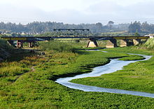
Andalién River
Appearance

The Andalién River is a river in the province of Concepcion that was formed north northeast of the city of Florida and flows west to and crosses part of the city of Concepción, Chile, and then north through the communes of Penco and Talcahuano, ending at the Bay of Concepción.
Sources
- Asta-Buruaga y Cienfuegos, Francisco Solano (1899). Diccionario geográfico de la República de Chile (second ed.). New York: D. Appleton and Company. pp. 31–32.
- Castillo, Edilia Jaque (2008). "Geomorfología de la cuenca del río Andalién, Chile". Revista Geográfica (in Spanish) (143): 97–116. JSTOR 40996764.
36°44′22″S 73°00′58″W / 36.73944°S 73.01611°W

