Arachalur Musical Inscription
| Arachalur Rock-cut Musical Inscription | |
|---|---|
| Religion | |
| Affiliation | Hinduism, Jainism |
| Location | |
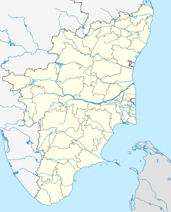
| Location | Nagamalai, Arachalur, Erode, Tamil Nadu, India |
| Geographic coordinates | 11°10′23″N 77°42′00″E / 11.173°N 77.7°E |
| Architecture | |
| Completed | 2nd century AD |
Arachalur Rock-cut Cave Musical Inscription, also known as Arachalur Isai Kalvettu is a rock cut historical site of musical inscriptions at the south of Nagamalai hill in Arachalur Reserve Forest near Erode in Tamil Nadu, India.[1][2]
The Inscriptions
[edit]There are three 2nd century CE Jain inscriptions in Arachalur, which Dr. S. Raju discovered. On a Jain bed in the Arachalur hills, is an inscription — ‘ezhuthum punaruthan maniya vannakkan devan sathan.’ The word ‘punaruthan’ is an alteration of punarthan, which means organised.[3] The other two inscriptions have musical syllables, which are the same when read from left to right, and vice versa; they are also the same when read from the top of a column to the bottom and vice versa. These two inscriptions show that 'Maniyan Vannakkan Devan Sathan' organised musical syllables.[4] "This inscription, which belongs to the same period as Silappadikaram, is centuries older than the 'Kudumiyamalai inscriptions' on music, and yet the Arachalur inscription hardly draws visitors," rues Dr.S. Raju.[3][5]
Location
[edit]


The site is located on the Erode-Palani State Highway-83A about 20 km from Erode Central Bus Terminus and 18 km from Erode Junction railway station.
References
[edit]- ^ "TN Archaeology - Arachalur" (PDF). Retrieved 27 June 2021.
- ^ "Tamil Navigation". Retrieved 27 June 2021.
- ^ a b Krishnamachari, Suganthy (12 October 2017). "On how Kongu Nadu was a Jain bastion". The Hindu. ISSN 0971-751X. Archived from the original on 23 October 2019. Retrieved 8 September 2019.
- ^ "11°10'19.6"N 77°41'28.7"E". 11°10'19.6"N 77°41'28.7"E. Retrieved 5 November 2020.
- ^ "ஈரோடு இசை கல்வெட்டு | Erode Music inscription | Tamilnavigation - YouTube". www.youtube.com. Retrieved 5 November 2020.

