
Arrey, New Mexico
Arrey, New Mexico | |
|---|---|
Census-designated place | |
 Arrey, New Mexico | |
| Coordinates: 32°50′55″N 107°19′09″W / 32.84861°N 107.31917°W | |
| Country | United States |
| State | New Mexico |
| County | Sierra |
| Area | |
| • Total | 0.790 sq mi (2.05 km2) |
| • Land | 0.790 sq mi (2.05 km2) |
| • Water | 0 sq mi (0 km2) |
| Elevation | 4,180 ft (1,270 m) |
| Population | |
| • Total | 232 |
| • Density | 290/sq mi (110/km2) |
| Time zone | UTC-7 (Mountain (MST)) |
| • Summer (DST) | UTC-6 (MDT) |
| Area code | 575 |
| GNIS feature ID | 898717[2] |
Arrey is a census-designated place in Sierra County, New Mexico, United States. It lies about 22 miles south of Truth or Consequences. As of the 2010 census, its population was 232.[1]
The name Arrey comes from French settlers in the 1800s. There are families with the last name Arrey mostly in southern New Mexico around Silver City and Las Cruces.[citation needed]
References
Municipalities and communities of Sierra County, New Mexico, United States | ||
|---|---|---|
| Cities | 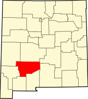 | |
| Villages | ||
| CDPs | ||
| Other communities | ||
| Ghost towns | ||
This New Mexico state location article is a stub. You can help Wikipedia by expanding it. |