
Ashville, Ohio
Ashville, Ohio | |
|---|---|
 Historic traffic light | |
 Location of Ashville, Ohio | |
| Country | United States |
| State | Ohio |
| County | Pickaway |
| Government | |
| • Mayor | Chuck Wise |
| • Village Administrator | Franklin Christman |
| Area | |
| • Total | 1.6 sq mi (4.0 km2) |
| • Land | 1.6 sq mi (4.0 km2) |
| • Water | 0.0 sq mi (0.0 km2) |
| Elevation | 709 ft (216 m) |
| Population (2000) | |
| • Total | 3,174 |
| • Density | 2,035.8/sq mi (786.0/km2) |
| Time zone | UTC-5 (Eastern (EST)) |
| • Summer (DST) | UTC-4 (EDT) |
| ZIP code | 43103 |
| Area code | 740 |
| FIPS code | 39-02680Template:GR |
| GNIS feature ID | 1064348Template:GR |
| Website | http://www.ashvilleohio.net/ |
Ashville is a village in Pickaway County, Ohio, United States. The population was 3,174 at the 2000 census.
History
A historical museum, Ohio's Small Town Museum, is operated in the community.[1] The museum, established in 1975, claims to be home to America's oldest working traffic light, which directed traffic in downtown Ashville until the 1970s. This signal was designed by local resident Teddy Boor.[2]
-
 Ashville corporation limit sign on Cromley Road
 -
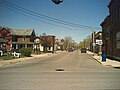 Looking north on Long Street in Ashville
 -
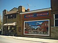 Ohio's Small Town Museum in Ashville
 -
 Ashville Grain, LLC
 -
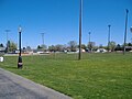
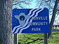 Ashville Community Park
 -
 Ashville Community Park
 -
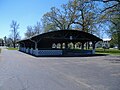 Ashville Community Park
 -
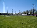
 Ashville Community Park
 -
 Ashville Community Park
 -
 World's Oldest Traffic Light water tower
 -
 Ashville Community Park
 -
 Ashville Community Park
 -
 Ashville Depot
 -
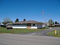 Village of Ashville Administrative Offices


Schools
Geography
Ashville is located at 39°43′03″N 82°57′10″W / 39.717550°N 82.952850°W.Template:GR
According to the United States Census Bureau, the village has a total area of 1.6 square miles (4.1 km2), all of it land.
Demographics
As of the censusTemplate:GR of 2000, there were 3,174 people, 1,243 households, and 872 families residing in the village. The population density was 2,035.8 people per square mile (785.6/km2). There were 1,337 housing units at an average density of 857.5 per square mile (330.9/km2). The racial makeup of the village was 97.83% White, 0.19% African American, 0.32% Native American, 0.06% Asian, 0.19% from other races, and 1.42% from two or more races. Hispanic or Latino of any race were 1.07% of the population.
There were 1,243 households out of which 40.4% had children under the age of 18 living with them, 52.5% were married couples living together, 13.4% had a female householder with no husband present, and 29.8% were non-families. 24.9% of all households were made up of individuals and 9.9% had someone living alone who was 65 years of age or older. The average household size was 2.55 and the average family size was 3.03.
In the village the population was spread out with 29.6% under the age of 18, 9.6% from 18 to 24, 33.8% from 25 to 44, 17.7% from 45 to 64, and 9.3% who were 65 years of age or older. The median age was 31 years. For every 100 females there were 93.5 males. For every 100 females age 18 and over, there were 85.3 males.
The median income for a household in the village was $40,778, and the median income for a family was $47,092. Males had a median income of $35,236 versus $22,231 for females. The per capita income for the village was $16,645. About 6.3% of families and 9.5% of the population were below the poverty line, including 11.5% of those under age 18 and 6.0% of those age 65 or over.
Government
Ashville is governed by the mayor-council system of government. In 2009, the mayor was Chuck Wise, and the members of council were Nelson Embrey, Gayle Blankenship, Chester Gloyd, Brian Garvine, Keith Moore, Terry L. Moore. The village employs a village administrator; in 2009, this position was occupied by Franklin Christman.[3]
Notable residents
- Champ Henson – college and professional football player
- John Holmes – adult film star
References
- ^ Ashville Area Heritage Society
- ^ Neato Stuff At the Ashville Museum, Ashville Museum. Accessed 2009-08-13.
- ^ 2009 Village of Ashville Officials, Ashville, 2009. Accessed 2009-09-15.
External links
Municipalities and communities of Pickaway County, Ohio, United States | ||
|---|---|---|
| City |  | |
| Villages | ||
| Townships | ||
| CDPs | ||
| Unincorporated communities | ||
| Ghost town | ||
| Footnotes | ‡This populated place also has portions in an adjacent county or counties | |