Awala-Yalimapo
Appearance
Awala-Yalimapo | |
|---|---|
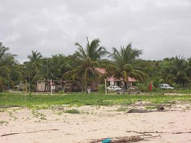
 Settlement of Yalimapo as seen from the beach of Plage des Hattes | |
 Location of the commune (in red) within French Guiana | |
| Coordinates: 5°44′28″N 53°55′40″W / 5.7411°N 53.9278°W | |
| Country | France |
| Overseas region and department | French Guiana |
| Arrondissement | Saint-Laurent-du-Maroni |
| Intercommunality | CC Ouest Guyanais |
| Government | |
| • Mayor (2014-2020) | Jean-Paul Ferreira |
| Area 1 | 187.4 km2 (72.4 sq mi) |
| Population (2014) | 1,364 |
| • Density | 7.3/km2 (19/sq mi) |
| Time zone | UTC−03:00 |
| INSEE/Postal code | 97361 /97319 |
| 1 French Land Register data, which excludes lakes, ponds, glaciers > 1 km2 (0.386 sq mi or 247 acres) and river estuaries. | |
Awala-Yalimapo is a commune on the north coast of French Guiana, close to the border with Suriname. The seat of the commune is the settlement of Awala where the town hall is located. Other settlements in the commune are: Yalimapo, Ayawande, and Piliwa. All of them are Kali'na Amerindian villages.
History
The commune of Awala-Yalimapo was created on 1 January 1989 by detaching its territory from the commune of Mana.
Geography
Awala and Yalimapo are French Guiana's northern-most settlements, located just to the south of the région's northernmost point, the beach of Plage des Hattes, the world’s largest leatherback turtle nesting site.
Demographics
The inhabitants of Awala-Yalimapo are in their majority Ameridians (Kaliña).
See also
References
External links
Wikimedia Commons has media related to Awala-Yalimapo.

