
Běchary
Běchary | |
|---|---|
Municipality and village | |
 | |
 Flag  Coat of arms | |
| Coordinates: 50°19′N 15°17′E / 50.317°N 15.283°E | |
| Country | |
| Region | Hradec Králové Region |
| District | Jičín District |
| Area | |
| • Total | 3.38 sq mi (8.76 km2) |
| Population (2006) | |
| • Total | 238 |
| Time zone | UTC+1 (CET) |
| • Summer (DST) | UTC+2 (CEST) |
Běchary is a village and municipality in Jičín District in the Hradec Králové Region of the Czech Republic. It is located 14 kilometres (8.7 mi) south of Jičín and 67 kilometres (42 mi) east of Prague.
The municipality covers an area of 8.76 square kilometres (3.38 sq mi) and as of 2006 it had a population of 238. First written notice about the village is from year 1290.
Gallery
-
 Elementary school
 -
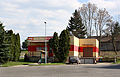 General store
 -
 Restaurant


Wikimedia Commons has media related to Běchary.
This Hradec Králové Region location article is a stub. You can help Wikipedia by expanding it. |