
Bad Saulgau
You can help expand this article with text translated from the corresponding article in German. (February 2009) Click [show] for important translation instructions.
|
Bad Saulgau | |
|---|---|
 Saint John the Baptist Church | |
 Coat of arms | |
Location of Bad Saulgau within Sigmaringen district 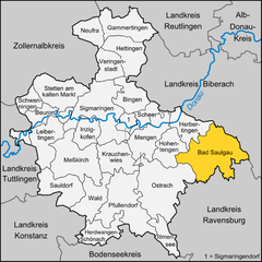 | |
| Country | Germany |
| State | Baden-Württemberg |
| Admin. region | Tübingen |
| District | Sigmaringen |
| Subdivisions | 14 |
| Government | |
| • Mayor | Doris Schröter |
| Area | |
| • Total | 97.34 km2 (37.58 sq mi) |
| Elevation | 587 m (1,926 ft) |
| Population (2022-12-31)[1] | |
| • Total | 17,702 |
| • Density | 180/km2 (470/sq mi) |
| Time zone | UTC+01:00 (CET) |
| • Summer (DST) | UTC+02:00 (CEST) |
| Postal codes | 88348 |
| Dialling codes | 07581 |
| Vehicle registration | SIG |
| Website | www.bad-saulgau.de |
Bad Saulgau is a town in the district of Sigmaringen, in Baden-Württemberg, Germany. It is situated 23 km east of Sigmaringen, and 27 km north of Ravensburg between the Danube and Lake Constance.
The location was already a Celtic settlement and owes its name to the spring goddess Sulis. The first historical reference to the settlement dates back to 819. In 1239, the town was acknowledged by Frederick II, Holy Roman Emperor. It became a possession of the House of Habsburg in 1299, and thus part of the Holy Roman Empire.
In Napoleonic times, it was given to the Kingdom of Württemberg. During World War II, a subcamp of the Dachau concentration camp was located in the town.[2] The name of the town was officially changed in 2000 from Saulgau to Bad Saulgau.
| Coat of arms | District | Inhabitants | Area |
|---|---|---|---|
| Bad Saulgau (main locality) | 11.673 | 5690 ha | |
| Bierstetten and Steinbronnen | 591 | 615 ha | |
| Bolstern and Heratskirch | 417 | 1206 ha | |
| Bondorf | 333 | 278 ha | |
| Braunenweiler/Untereggartsweiler | 553 | 1005 ha | |
| Friedberg | 406 | 541 ha | |
| Fulgenstadt | 672 | 673 ha | |
| Großtissen and Kleintissen | 374 | 669 ha | |
| Haid-Sießen-Bogenweiler | 874 | 1320 ha | |
| Hochberg and Luditsweiler | 579 | 664 ha | |
| Lampertsweiler | 302 | 252 ha | |
| Moosheim | 337 | 443 ha | |
| Renhardsweiler | 273 | 170 ha | |
| Wolfartsweiler | 275 | 351 ha |
Education
This section needs expansion. You can help by adding to it. (April 2015) |
Toin Gakuen Schule Deutschland, a Japanese international boarding school serving secondary school, was previously in Bad Saulgau. The school was scheduled to close in 2012.[3]
Famous People
- Joseph Ruf (1905-1940), conscientious objector, victim of the Nazi regime
- Kurt Seidel (1921-2001), historian
- Franz Michelberger (born 1955), football player
- Günther-Martin Pauli (born 1965), politician (CDU), member of the Landtag of Baden-Württemberg
- Michael Bulander (boprn 1971), mayor of Mössingen
- Martin Rosemann (born 1976), politician (SPD), Bundestag deputy
- Stefan Buck (born 1980), football player
- Fabian Gerster (born 1986), football player
- Tatjana Maria born Malek (born 1987), tennis player
- Isabelle Harle (born 1988), swimmer and multiple German champion, world and European champion
Notes
- ^ "Bevölkerung nach Nationalität und Geschlecht am 31. Dezember 2022" [Population by nationality and sex as of December 31, 2022] (CSV) (in German). Statistisches Landesamt Baden-Württemberg. June 2023.
- ^ glosk.com/GM/Linde/17283/pages/List_of_subcamps_of_Dachau/84737_en.htm
- ^ "Japanische Schule kehrt Bad Saulgau den Rücken" (Archive). Südkurier. 20 March 2010. Retrieved on 6 January 2015.
Towns and municipalities in Sigmaringen (district) | ||
|---|---|---|
| International | |
|---|---|
| National | |
| Geographic | |
This Sigmaringen district location article is a stub. You can help Wikipedia by expanding it. |