Barclay, Texas
Appearance
Barclay, Texas | |
|---|---|
| Coordinates: 31°4′35″N 97°6′33″W / 31.07639°N 97.10917°W | |
| Country | |
| State | |
| County | |
| Elevation | 520 ft (160 m) |
| Population (2009 local estimate)[1] | |
| • Total | 58 |
| Time zone | UTC-6 (Central (CST)) |
| • Summer (DST) | UTC-5 (CDT) |
| ZIP code | 76656 |
| Area code | 254 |
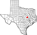
Barclay is an unincorporated community in southwest Falls County, Texas, United States. Barclay, the southernmost community in Falls County, is located on Farm-to-market road 413. The estimated population was 58 in 2009.[1]
References


