Beragala
Appearance
Beragala | |
|---|---|
 | |
 | |
| Country | Sri Lanka |
| Province | Uva |
| District | Badulla |
| Time zone | UTC+5:30 (Sri Lanka Standard Time Zone) |
Beragala is a small town in Sri Lanka. It is located in Badulla District of Uva Province, Sri Lanka.[1] It is located 183 km away from Colombo along the A4 Highway.[2] The area is very famous for the natural beauty and landslides.[3]
Attractions

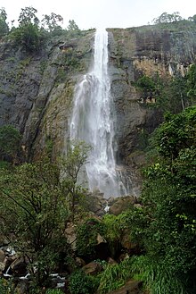
- Diyaluma Falls Koslanda
- Bambarakanda Falls
- Panoramic View of Southern and Sabaragamuwa provinces
- Koslanda Falls
Transport
- A16 High Way, Beragala-Hali-ela[4]
- A04 Highway, Colombo-Ratnapua-Balangoda-Beragala-Koslanda-Wellawaya-Pottuvil-Batticaloa[5] (Route 99)
Hotels
Hotel Near Diyaluma Falls, Diyaluma Falls Inn
Gallery
-
The Small Town
-
The Junction, splits the A4 road to Haputale and Wellawaya
-
Lowland rain forest and hills near Beragala.


