
Bierawa
Bierawa | |
|---|---|
Village | |
 Road | |
 Bierawa | |
| Coordinates: 50°17′9″N 18°14′32″E / 50.28583°N 18.24222°E | |
| Country | |
| Voivodeship | Opole |
| County | Kędzierzyn-Koźle |
| Gmina | Bierawa |
| Population | 1,370 |
| Website | http://www.bierawa.pl/ |
Bierawa [bjɛˈrava] (German: Birawa, 1936-45: Reigersfeld) is a village in Kędzierzyn-Koźle County, Opole Voivodeship, in south-western Poland. It is the seat of the gmina (administrative district) called Gmina Bierawa.[1] It lies approximately 8 kilometres (5 mi) south-east of Kędzierzyn-Koźle and 48 km (30 mi) south-east of the regional capital Opole.
Before 1945 the area was part of Germany (see Territorial changes of Poland after World War II).
The village has a population of 1,370.
Gallery
-
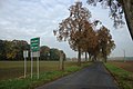 Road to the village
 -
 Houses
 -
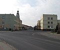 Crossroads


References
Wikimedia Commons has media related to Bierawa.
| Seat |  | |
|---|---|---|
| Other villages | ||
50°17′9″N 18°14′32″E / 50.28583°N 18.24222°E
This Kędzierzyn-Koźle County location article is a stub. You can help Wikipedia by expanding it. |