Bloomfield River
| Bloomfield River | |
|---|---|
 | |
| Physical characteristics | |
| Mouth | Weary Bay, Pacific Ocean |

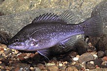
The Bloomfield River is a river situated in Queensland, north of Daintree. The river enters the sea north of Cape Tribulation and is noted for its Bloomfield River cod fish species, found only in the river. The river estuary is in near pristine conditions.[1]
It was originally named "Blomfield's Rivulet" on 26 June, 1818 by Phillip Parker King[2] It is prohibited to catch the Bloomfield river cod in Queensland.[3]
The controversial Bloomfield Track which connects Cape Tribulation with Cooktown, crosses the Bloomfield River. This crossing was closed in 2011 by the Cairns Regional Council after Cyclone Yasi destroyed the existing causeway.[4] A passenger-only ferry service has been in use until a four-wheel only temporary crossing is built.
By some accounts the Cape York Peninsula begins north of the Bloomfield River.[citation needed]
See also
References
- ^ "Estuary Assessment 2000: Bloomfield River". Australian Natural Resource Atlas. Department of Sustainability, Environment, Water, Population and Communities. Retrieved 24 May 2011.
- ^ The Narrative of a Survey, Vol. I.
- ^ "Bloomfield river cod". Primary Industries and fisheries. Department of Employment, Economic Development and Innovation). 21 June 2010. Retrieved 24 May 2011.
- ^ Abigal Stanbridge (16 May 2011). "Traders face 'immeasurable suffering' if Bloomfield crossing delayed". ABC News. Australian Broadcasting Corporation. Retrieved 24 May 2011.
