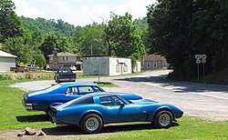
Breaks, Virginia
Appearance
Breaks, Virginia | |
|---|---|
Unincorporated community | |
 Breaks | |
| Coordinates: 37°17′45″N 82°16′52″W / 37.29583°N 82.28111°W | |
| Country | United States |
| State | Virginia |
| County | Dickenson |
| Elevation | 1,476 ft (450 m) |
| Time zone | UTC−5 (Eastern (EST)) |
| • Summer (DST) | UTC−4 (EDT) |
| GNIS feature ID | 1494190[1] |
Breaks is a small unincorporated community in Dickenson County, Virginia, United States.[1] Breaks is located very close to the Kentucky border and is east of Breaks Interstate Park. Breaks gets its name in reference to the "break" in Pine Mountain, a mountain range that spans along the Kentucky-Virginia border and ends near the community of Breaks.[2]
It was in Breaks that U.S. Senator George Allen called S. R. Sidarth, a volunteer for the Jim Webb campaign and an Indian American, a macaca. This started a controversy that gained national attention.
Attractions
- Breaks Interstate Park
- Russell Fork River, a popular whitewater rafting stream
- Willowbrook Country Club, a 9-hole golf course.
References
- ^ a b U.S. Geological Survey Geographic Names Information System: Breaks
- ^ Moyer, Armond; Moyer, Winifred (1958). The origins of unusual place-names. Keystone Pub. Associates. p. 16.


