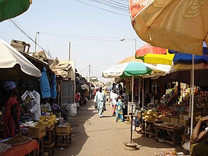
Brikama
Brikama Chapan | |
|---|---|
 | |
| Coordinates: 13°16′N 16°39′W / 13.267°N 16.650°W | |
| Country | The Gambia |
| Division | Brikama Local Government Area |
| Time zone | UTC+0 (GMT) |
Brikama is one of the largest cities in the Gambia, lying south of the country's capital, Banjul. Brikama is the headquarters of the Brikama Local Government Area (formerly the Western Division), being the largest city in the division with a population of over 57,000.[1]
Brikama is known for wood carving and for its musicians. Local attractions include the Makasutu Culture Forest.
Brikama is also home to numerous educational institutions including The Gambia College, which trains the nation's teachers, and the Regional Education Office for the Western Region of the country. In addition, there are five Secondary Schools (Kinderdorf Bottrop, Kunte Kinte, st.vincent, Maahad, and Methodist Academy) as well as a number of basic cycle schools. 13°16′N 16°39′W / 13.267°N 16.650°W
External links
References
- ^ Western Division, The Atlas of the Gambia (Columbia University). Retrieved 2012-04-30.

