Butter Valley Golf Port
Butter Valley Golf Port | |||||||||||
|---|---|---|---|---|---|---|---|---|---|---|---|
| Summary | |||||||||||
| Airport type | Public | ||||||||||
| Owner/Operator | John L. Gehman | ||||||||||
| Location | Bally, Pennsylvania | ||||||||||
| Elevation AMSL | 500 ft / 152 m | ||||||||||
| Coordinates | 40°23′53″N 075°33′52″W / 40.39806°N 75.56444°W | ||||||||||
| Website | buttervalley.com/airport.htm | ||||||||||
| Map | |||||||||||
| Runways | |||||||||||
| |||||||||||
| Statistics (2010) | |||||||||||
| |||||||||||
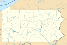
Butter Valley Golf Port (FAA LID: 7N8) is a privately owned, public-use airport located on the Butter Valley Golf Port golf course, located one nautical mile (1.85 km) east of the borough of Bally in Montgomery County, Pennsylvania, United States. Actually, it is a golf course with a small airstrip on it. [1]
Facilities and aircraft
Butter Valley Golf Port covers an area of 10 acres (4.0 ha) and contains one runway designated 16/34 with a 2,420 feet (740 m) x 85 feet (26 m) asphalt/turf surface[1] which includes a 1,535 feet (468 m) paved section.[2]
For the 12-month period ending April 16, 2010, the airport had 3,500 general aviation aircraft operations, an average of 10 per day. There are 16 aircraft based at this airport: 94% single-engine and 6% multi-engine. [1]
References
- ^ a b c d FAA Airport Form 5010 for 7N8 PDF, effective 2010-09-23
- ^ a b Butter Valley Golf Port, official site
External links
- Resources for this airport:
- FAA airport information for 7N8
- AirNav airport information for 7N8
- FlightAware airport information and live flight tracker
- SkyVector aeronautical chart for 7N8

