Cầu River
| Cầu River | |
|---|---|
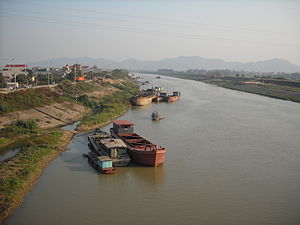
 Cầu River at Việt Yên, Bắc Giang | |
| Physical characteristics | |
| Source | |
| • location | Vietnam |
| Length | 288 km (179 mi) |
| Basin size | 6,030 km2 (2,330 sq mi) |
| Basin features | |
| Tributaries | |
| • left | Cà Lồ River, Công River |
Cầu River (Vietnamese: Sông Cầu) is a river of northern Vietnam. It flows through the provinces/cities of Bắc Kạn, Thái Nguyên, Bắc Giang, Hanoi, Bắc Ninh. It begins at the Phia Bioóc Peak in Chợ Đồn District, west of mountainous province of Bắc Kạn.
The river has a length of 288 km and basin area of 6030 km².
![]() Media related to Cau River at Wikimedia Commons
Media related to Cau River at Wikimedia Commons
21°07′26″N 106°17′52″E / 21.12389°N 106.29778°E
