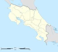
Carmona District, Nandayure
Appearance
Carmona | |
|---|---|
District and town | |
| Coordinates: 09°59′46″N 85°15′17″W / 9.99611°N 85.25472°W | |
| Country | Costa Rica |
| Province | Guanacaste |
| Canton | Nandayure |
| Area | |
| • Total | 34.19 km2 (13.20 sq mi) |
| Elevation | 80 m (260 ft) |
| Population (June 2013) | |
| • Total | 2,451 |
| • Density | 72/km2 (190/sq mi) |
| Postal code | 50901 |
Carmona District is a district and town in the canton of Nandayure, Guanacaste Province in Costa Rica.[1]
Located on the Nicoya Peninsula, the district has a population of around 2,500 people.[2]
Villages
Administrative center of the district is the village of Carmona.
Other villages in the district are Camas, Limones, Maquenco, San Rafael and Vista de Mar.[1]
References
- ^ a b "Carmona". Archived from the original on 2015-04-02. Retrieved 2015-03-28.
{{cite web}}: Unknown parameter|deadurl=ignored (|url-status=suggested) (help) - ^ Estadísticas Vitales 2013 - INEC

