Carrick Castle (village)
Carrick Castle
| |
|---|---|
 Carrick Castle village, with tenement to left of tower house | |
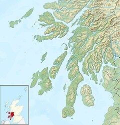
Location within Argyll and Bute | |
| OS grid reference | NS 19200 94500 |
| Council area |
|
| Lieutenancy area |
|
| Country | Scotland |
| Sovereign state | United Kingdom |
| Post town | DUNOON, ARGYLL |
| Postcode district | PA24 |
| Dialling code | 01301 |
| UK Parliament |
|
| Scottish Parliament |
|
Carrick Castle is a village on the western shore of Loch Goil,[1] 7 km (4.3 mi) south of Lochgoilhead by a minor road along the loch shore, on the Cowal Peninsula, in Argyll and Bute, west of Scotland. It is within the Argyll Forest Park, and also within the Loch Lomond and The Trossachs National Park.[2]

In 1877 a wooden pier was built at the castle, and a three-storey tenement building called Hillside Place was constructed inland from the castle, to provide apartments for visiting tourists. This was followed by several villas built along the shore road as accommodation for Glasgow merchants, developing what became a small village.[3]
The village church is listed on the buildings at risk register of Scotland.[4] There is a path to Ardentinny from Carrick Castle village.[5]
Carrick Castle tower house
[edit]Carrick Castle, a 15th-century castle built on a rock on the shoreline of Loch Goil, was originally a Clan Lamont stronghold.[6]

References
[edit]- ^ Ordnance Survey map
- ^ "Explore by map". Loch Lomond & The Trossachs National Park.
- ^ "Carrick Castle, Hillside Place (LB50351)". Historic Environment Scotland. Retrieved 30 April 2019.
- ^ "Carrick Castle Church, Carrick Castle". Buildings at Risk Register. Archived from the original on 26 April 2023. Retrieved 6 August 2019.
- ^ "Ardentinny Forest walks". Walkhighlands. Retrieved 6 August 2019.
- ^ "Carrick Castle". Canmore. Retrieved 6 August 2019.
- Map sources for Carrick Castle (village)

