Catawissa, Pennsylvania
Catawissa, Pennsylvania | |
|---|---|
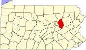
 Map showing Catawissa in Columbia County | |
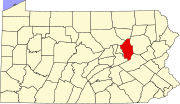
 Map showing Columbia County in Pennsylvania | |
| Country | United States |
| State | Pennsylvania |
| County | Columbia |
| Settled | 1774 |
| Incorporated | 1892 |
| Government | |
| • Type | Borough Council |
| • Mayor | Patrick Sinclair |
| Area | |
| • Total | 0.5 sq mi (1.4 km2) |
| Population (2000) | |
| • Total | 1,589 |
| • Density | 2,964.1/sq mi (1,136.1/km2) |
| Time zone | UTC-5 (Eastern (EST)) |
| • Summer (DST) | UTC-4 (EDT) |
| Zip code | 17820 |
| Area code | 570 |
| Website | Catawissa |
Catawissa is a borough in Columbia County, Pennsylvania, United States. The population was 1,589 at the 2000 census. It is part of the Bloomsburg–Berwick Micropolitan Statistical Area.
Catawissa is twinned with Uxbridge, Ontario. The historic link began in 1805, when the Uxbridge area was granted by the Crown to Dr. Christopher Beswick, first medical doctor north of the Oak Ridges Moraine. While not a Quaker, he lived in Catawissa before moving to the Uxbridge area. Beswick Lane in the Ontario town is named after him.[1]
Geography
Catawissa is located at 40°57′9″N 76°27′37″W / 40.95250°N 76.46028°WInvalid arguments have been passed to the {{#coordinates:}} function (40.952458, -76.460393)Template:GR on the north branch of the Susquehanna River.
According to the United States Census Bureau, the borough has a total area of 0.5 square miles (1.4 km²), all of it land.
Demographics
As of the censusTemplate:GR of 2000, there were 1,589 people, 710 households, and 428 families residing in the borough. The population density was 2,964.1 people per square mile (1,136.1/km²). There were 762 housing units at an average density of 1,421.4/sq mi (544.8/km²). The racial makeup of the borough was 97.48% White, 0.69% African American, 0.19% Asian, 0.31% from other races, and 1.32% from two or more races. Hispanic or Latino of any race were 0.44% of the population.
There were 710 households out of which 27.3% had children under the age of 18 living with them, 42.5% were married couples living together, 14.1% had a female householder with no husband present, and 39.7% were non-families. 35.4% of all households were made up of individuals and 20.3% had someone living alone who was 65 years of age or older. The average household size was 2.23 and the average family size was 2.89.
In the borough the population was spread out with 24.2% under the age of 18, 8.1% from 18 to 24, 26.9% from 25 to 44, 20.4% from 45 to 64, and 20.5% who were 65 years of age or older. The median age was 38 years. For every 100 females there were 78.7 males. For every 100 females age 18 and over, there were 75.7 males.
The median income for a household in the borough was $30,262, and the median income for a family was $37,292. Males had a median income of $30,987 versus $21,210 for females. The per capita income for the borough was $16,154. About 11.8% of families and 15.9% of the population were below the poverty line, including 25.1% of those under age 18 and 13.1% of those age 65 or over.
Famous denizens
Birthplace of Samuel Lount, a leader of the Rebellions of 1837, and one of two men hanged for his participation.

