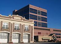
CenturyLink Tower
| CenturyLink Tower | |
|---|---|
 | |
 | |
| General information | |
| Type | Corporate Offices |
| Location | Sioux Falls, South Dakota |
| Coordinates | 43°32′48″N 96°43′49″W / 43.54667°N 96.73028°W |
| Completed | 1986 |
| Height | |
| Antenna spire | none |
| Roof | 174 ft (53 m) |
| Top floor | unknown |
| Technical details | |
| Floor count | 11 |
| Lifts/elevators | 6 |
CenturyLink Tower (formerly Qwest Tower) is an office building located in downtown Sioux Falls, South Dakota. It is 174 feet tall and has 11 stories, dominates the skyline of Sioux Falls, and is the tallest building in the state of South Dakota. Previously the 202-foot Zip Feed Tower was the tallest building in Sioux Falls, as well as South Dakota.
History and appearance
The building has had two different facades - initially it was of white stone, but structural issues that soon developed forced US West (later known as Qwest) to remove the outer facade and later install the present exterior. One portion of this building was actually constructed of brick and was the original telephone exchange building until its demolition in 2011 to make room for expanded parking.
Modern ownership
The building is now a dispatch center owned by CenturyLink
