Cerhenice
Appearance
Cerhenice | |
|---|---|
Municipality and market town | |
 Cerhenice | |
|
Coat of arms of Cerhenice Coat of arms | |
 | |
| Country | |
| Region | Central Bohemian Region |
| District | Kolín District |
| Area | |
• Total | 4.10 sq mi (10.63 km2) |
| Elevation | 686 ft (209 m) |
| Population (2011) | |
• Total | 1,628 |
| • Density | 400/sq mi (150/km2) |
| Time zone | UTC+1 (CET) |
| • Summer (DST) | UTC+2 (CEST) |
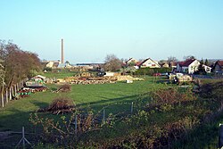
Cerhenice is a market town and municipality in Kolín District in the Central Bohemian Region of the Czech Republic. Also, Cerhenice is the name of the palace in the town.
Notes
- This article was initially translated from the Czech Wikipedia.
50°05′N 15°05′E / 50.083°N 15.083°E
Wikimedia Commons has media related to Cerhenice.

