
Châteaugiron
Châteaugiron
Kastell-Geron | |
|---|---|
 Chateau | |
.svg) Coat of arms | |
Location of Châteaugiron  | |
 Châteaugiron  Châteaugiron | |
| Coordinates: 48°02′56″N 1°30′07″W / 48.0489°N 1.5019°W | |
| Country | France |
| Region | Brittany |
| Department | Ille-et-Vilaine |
| Arrondissement | Rennes |
| Canton | Châteaugiron |
| Intercommunality | Pays de Châteaugiron |
| Government | |
| • Mayor (2014–2020) | Françoise Gatel |
| Area 1 | 23.52 km2 (9.08 sq mi) |
| Population (2014) | 9,434 |
| • Density | 400/km2 (1,000/sq mi) |
| Time zone | UTC+01:00 (CET) |
| • Summer (DST) | UTC+02:00 (CEST) |
| INSEE/Postal code | 35069 /35410 |
| Elevation | 28–78 m (92–256 ft) |
| 1 French Land Register data, which excludes lakes, ponds, glaciers > 1 km2 (0.386 sq mi or 247 acres) and river estuaries. | |
Châteaugiron (Breton: Kastell-Geron, Gallo: Chaujon) is a commune in the Ille-et-Vilaine department of Brittany in northwestern France. It extended on 1 January 2017 by merging with the former communes of Saint-Aubin-du-Pavail and Ossé.[1]
Population
Inhabitants of Châteaugiron are called Castelgironnais in French.
| Year | Pop. | ±% |
|---|---|---|
| 1962 | 1,682 | — |
| 1968 | 2,060 | +22.5% |
| 1975 | 2,330 | +13.1% |
| 1982 | 3,244 | +39.2% |
| 1990 | 4,166 | +28.4% |
| 1999 | 5,500 | +32.0% |
| 2008 | 6,450 | +17.3% |
Sister cities
 Puszczykowo, Poland[2]
Gallery
-
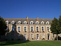 Town hall
 -


See also
References
- ^ Template:Fr Arrêté du 13 juin 2016 portant création de la commune nouvelle de Châteaugiron
- ^ "Les jumelages". Chateaugiron. Retrieved 2 June 2014.
External links
Wikimedia Commons has media related to Châteaugiron.
This Ille-et-Vilaine geographical article is a stub. You can help Wikipedia by expanding it. |