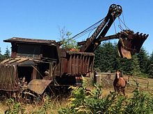
Chimacum, Washington
This article needs additional citations for verification. (July 2015) |

Chimacum is an unincorporated community in Jefferson County, Washington, United States, located in the center of the primary agricultural area of the eastern Olympic Peninsula.[1] It was named after the Chimakum (also spelled Chemakum or Chimacum) group of Indigenous Americans that lived there until the late 19th century but are now extinct as a distinct cultural group after losing successive conflicts with neighboring tribes.[2]
The Chimacum Valley remains and maintains an identity as a progressive agricultural area with many small locally owned farmsteads, a full-service farmstand grocer carrying locally produced goods, and a community farmers' market held from June to October each Sunday from 10 AM to 2 PM. The area is also served by a local branch of The National Grange of the Order of Patrons of Husbandry, which celebrated its 100th anniversary in 2018.


In May 2014 the Jefferson County Land Trust in collaboration with Washington State University have designated over 15 acres of undeveloped agricultural land in central Chimacum to be reserved as incubator farms and called the Chimacum Commons. This project envisions an educational and trade hub offering both affordable, clustered local housing and a workspace for agricultural and horticultural science students and small-scale farming professionals to develop, grow, and master their crafts.[3]

Chimacum is the home of Chimacum Schools' main campus, which serves the unincorporated communities of east Jefferson County to the south of Port Townsend and north of Quilcene, including Chimacum itself, Port Hadlock, Irondale, Marrowstone Island, Oak Bay, Paradise Bay, Port Ludlow, and Shine.
Betty MacDonald's The Egg and I, the book upon which the Ma and Pa Kettle films were based, described the author's experiences on a chicken farm on the road that became Egg & I Rd, Chimacum.
Linda Perhacs's 1970 album Parallelograms contains the song "Chimacum rain," a work inspired by Chimacum's natural environment.[citation needed]
Chimacum is the hometown of Lieutenant Colonel Nathan A. Guthrie, Bronze Star recipient from Operation Enduring Freedom and Operation Iraqi Freedom.[4]
References
- ^ "Chimacum". Geographic Names Information System. United States Geological Survey, United States Department of the Interior.
- ^ Ruby, Robert H.; John Arthur, Brown (1992). A Guide to the Indian Tribes of the Pacific Northwest. University of Oklahoma Press. pp. 22–23, 28. ISBN 978-0-8061-2479-7.
- ^ "Archived copy". Archived from the original on 2015-09-06. Retrieved 2015-07-30.
{{cite web}}: CS1 maint: archived copy as title (link) - ^ https://www.benning.army.mil/armor/earmor/content/issues/2015/jan_mar/2014index.html
48°1′N 122°46′W / 48.017°N 122.767°W

