
Cimarron Township, Gray County, Kansas
Cimarron Township | |
|---|---|
 Location in Gray County | |
| Coordinates: 37°47′35″N 100°19′27″W / 37.79306°N 100.32417°W | |
| Country | United States |
| State | Kansas |
| County | Gray |
| Area | |
| • Total | 98.28 sq mi (254.54 km2) |
| • Land | 98.25 sq mi (254.47 km2) |
| • Water | 0.03 sq mi (0.07 km2) 0.03% |
| Elevation | 2,598 ft (792 m) |
| Population (2000) | |
| • Total | 2,379 |
| • Density | 24.2/sq mi (9.3/km2) |
| GNIS feature ID | 0471651 |
Cimarron Township is a township in Gray County, Kansas, USA. As of the 2000 census, its population was 2,379.
Geography
Cimarron Township covers an area of 98.28 square miles (254.5 km2) and contains one incorporated settlement, Cimarron, which is also the county seat.
Transportation
Cimarron Township contains one airport or landing strip, Cimarron Municipal Airport.
References
External links
Municipalities and communities of Gray County, Kansas, United States | ||
|---|---|---|
| Cities | 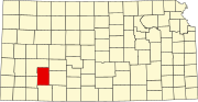 | |
| Unincorporated communities | ||
| Townships | ||
This article about a location in Gray County, Kansas is a stub. You can help Wikipedia by expanding it. |