Colin (river)
| Colin | |
|---|---|
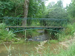
 River at Sainte-Solange | |
| Physical characteristics | |
| Source | |
| • location | Humbligny |
| Mouth | |
• location | Yèvre |
| Length | 29.1 km (18.1 mi) |
| Basin features | |
| Progression | Yèvre→ Cher→ Loire→ Atlantic Ocean |
The Colin is a 29.1-kilometre (18.1 mi) long[1][2] river in the French department of Cher. It is an affluent of the Yèvre and a sub-affluent of la Loire.
Geography
The river's source is at Humbligny, where it drains La Motte d'Humbligny, the highest point in the Sancerrois region. It runs through Les Aix-d'Angillon and Sainte-Solange and joins the Yèvre at Saint-Germain-du-Puy.
Communes
Humbligny, Morogues, Aubinges, Les Aix-d'Angillon, Sainte-Solange, Saint-Germain-du-Puy,
References
- ^ Sandre. "Fiche (K5564200)". Retrieved 31 July 2015.
{{cite web}}: Cite has empty unknown parameters:|éditeur=and|année=(help) - ^ Sandre. "Fiche ruisseau le colin (K5564201)". Retrieved 21 December 2009.
{{cite web}}: Cite has empty unknown parameters:|éditeur=and|année=(help)
