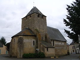
Courtillers
Appearance
Courtillers | |
|---|---|
 The church of Saint Jean Baptiste | |
| Coordinates: 47°48′00″N 0°18′00″W / 47.8°N 0.300000°W | |
| Country | France |
| Region | Pays de la Loire |
| Department | Sarthe |
| Arrondissement | La Flèche |
| Canton | Sablé-sur-Sarthe |
| Intercommunality | Communauté de communes de Sablé-sur-Sarthe |
| Government | |
| • Mayor (2008–2014) | Dominique Leroy |
| Area 1 | 7.24 km2 (2.80 sq mi) |
| Population (2006 [1]) | 803 |
| • Density | 110/km2 (290/sq mi) |
| Demonym(s) | Courtilléen, Courtilléenne |
| Time zone | UTC+01:00 (CET) |
| • Summer (DST) | UTC+02:00 (CEST) |
| INSEE/Postal code | 72106 /72300 |
| Elevation | 34–55 m (112–180 ft) |
| 1 French Land Register data, which excludes lakes, ponds, glaciers > 1 km2 (0.386 sq mi or 247 acres) and river estuaries. | |
Courtillers is a commune in the Sarthe department in the Pays de la Loire region in north-western France.
See also
References
- ^ http://www.insee.fr/fr/ppp/bases-de-donnees/recensement/populations-legales/departement.asp?dep=72#dep_B Populations légales 2006 publiées par l’INSEE le 1er janvier 2009
Wikimedia Commons has media related to Courtillers.


