Cullingford Field
Appearance
Cullingford Field | |||||||||||
|---|---|---|---|---|---|---|---|---|---|---|---|
| Summary | |||||||||||
| Airport type | Private | ||||||||||
| Owner/Operator | U.S. Fish & Wildlife Service | ||||||||||
| Location | Cabo Rojo, near Boquerón, Puerto Rico | ||||||||||
| Elevation AMSL | 14 ft / 4 m | ||||||||||
| Coordinates | 17°58′35″N 067°10′15″W / 17.97639°N 67.17083°W | ||||||||||
| Map | |||||||||||
 | |||||||||||
| Runways | |||||||||||
| |||||||||||
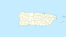
Cullingford Field (FAA LID: PR24) is a small airstrip owned and operated by the United States Fish and Wildlife Service near Boquerón in the municipality of Cabo Rojo, Puerto Rico. Located within the Cabo Rojo National Wildlife Refuge, it has a single 1500 foot turf runway and is used exclusively by Fish and Wildlife personnel.
References
- ^ FAA Airport Form 5010 for PR24 PDF, effective 2007-12-20 [dead link]

