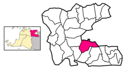
Curug, Tangerang
Appearance
Curug | |
|---|---|
Town and district | |
 District location | |
| Coordinates: 6°22′16″S 106°48′0″E / 6.37111°S 106.80000°E | |
| Country | Indonesia |
| Province | Banten |
| Regency | Tangerang Regency |
| Area | |
| • Total | 30.83 km2 (11.90 sq mi) |
| Population (mid 2023 estimate)[1] | |
| • Total | 176,620 |
| • Density | 5,700/km2 (15,000/sq mi) |
Curug is a town and an administrative district (kecamatan) within Tangerang Regency in the province of Banten, on Java, Indonesia. The district covers a land area of 30.83 km2 and had a population of 165,812 at the 2010 Census[2] and 174,867 at the 2020 Census;[3] the official estimate as at mid 2023 was 176,620.[1] The administrative centre is at Cukanggalih, and the district is sub-divided into 3 urban kelurahan (Binong, Curug Kulon and Sukabakti) and 4 rural villages (desa), all sharing the postcode of 15810.


