Czeska Wieś
Appearance
Czeska Wieś | |
|---|---|
Village | |
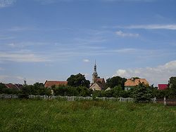
 Panoramic view of Czeska Wieś | |
| Coordinates: 50°45′0″N 17°29′0″E / 50.75000°N 17.48333°E | |
| Country | |
| Voivodeship | Opole |
| County | Brzeski |
| Gmina | Olszanka |
| Population (2006) | 440 |
| Time zone | UTC+1 (CET) |
| • Summer (DST) | UTC+2 (CEST) |
| Postal Code | 49-332 Olszanka |
| Area code | +48(0-77)... |
| Car plates | OB |
| Website | http://www.olszanka.pl |
Czeska Wieś [ˈt͡ʂɛska ˈvjɛɕ] ("Czech village"), formerly German Böhmischdorf ("Boehmia village"), is a village in Poland situated in Opole Voivodeship, in Brzeg County, in Gmina Olszanka.[1] It lies approximately 6 kilometres (4 mi) south of Olszanka, 15 km (9 mi) south of Brzeg, and 32 km (20 mi) west of the regional capital Opole.


References
50°44′N 17°30′E / 50.733°N 17.500°E

