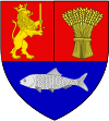
Dăbuleni
Appearance
Dăbuleni | |
|---|---|
Town | |
| Coordinates: 43°48′04″N 24°05′31″E / 43.80111°N 24.09194°E | |
| Country | |
| County | Dolj County |
| Status | Town |
| Population (2002) | |
| • Total | 13,888 |
| Time zone | UTC+2 (EET) |
| • Summer (DST) | UTC+3 (EEST) |
| Year | Pop. | ±% |
|---|---|---|
| 2002 | 13,888 | — |
| 2011 | 11,861 | −14.6% |
| Source: Census data | ||
Dăbuleni (Romanian pronunciation: [dəbuˈlenʲ]) is a town of Dolj County, known for the sandy areas surrounding it, since the 1980s have become part of an 80,000 hectares (800 km², 310 mi²) desert, known as the Oltenian Sahara. The town is the only place in Europe where an official Sand Museum exists. It was declared a town in 2004 (Law no. 83/2004). If the north part of the town is a desert, the south part, a Danube flooding area known as the "Melon Kingdom", from which the "Dăbuleni" melons, are famous in all Romania.
One village, Chiașu, is administered by the town.
Wikimedia Commons has media related to Dăbuleni.


